
Everest Alpine Trekking“The Jugal Himal Base Camp Trek” around the secluded region of the Mid-Eastern Himalayas. An adventure within hidden pockets of Central Himalayas amidst Jugal Himal massif snow-capped peaks. A perfect adventure on ‘off the beaten track’ for those who are interested in trekking in the complete mountain wilderness
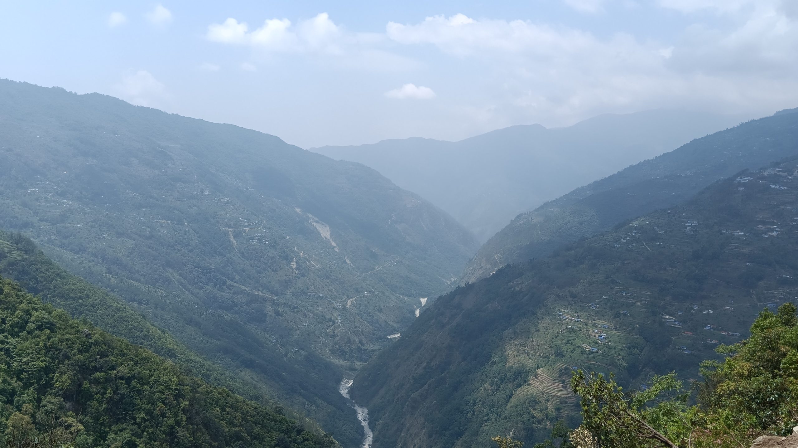
The Ultimate Jugal Himal Adventure leads you away from human civilization for more than a week. Walking in tranquil surroundings with only the sound of blissful nature in the close shadow of Jugal Himal. This raw and wild region offers stunning dramatic scenery of towering mountains dusted in snow. The walk leads towards the holy lakes of Panch Pokhari and Bhairab Kunda, enclosed by hills and snow peaks.
Overview
Jugal Himal base camp Trek is the nearest mountain to the capital of Nepal, Kathmandu. It lies 140 kilometers northeast of the capital city. The easiest route to get to Jugal Himal is to sort out your way from Kathmandu to Chautara in Sindhupalchowk.
From Chautara, you will hike to Syaule, Kamikharka Danda, Hile Bhanjyang, and finally, reach Panch Pokhari. You can go through the following breakdown of the itinerary for the Jugal Himal Trek:
Highlights
- Explore authentic Sherpa villages, witness unique traditions, and visit historical sites like the meditation cave of Guru Rinpoche.
- Stunning scenery of mountains dusted with snow amidst beautiful surroundings.
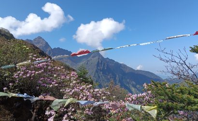
- Breathtaking views of the Jugal Himal Range, Langtang Peaks, and sacred Panchpokhari Lakes, along with pristine glaciers
- Enchanting forest lined with tall rhododendrons, magnolia, oaks, and pine trees.
- Adventure around remote corners of the Central Mountain range of Jugal Himal.
- Trek through lush forests, alpine meadows, and rugged terrains, crossing suspension bridges and waterfalls.
Welcome to Kathmandu! Upon arrival at Tribhuvan International Airport, our team will assist you and transfer you to your hotel. After settling in, you’ll receive a briefing on your exciting itinerary. Enjoy a relaxing evening in this vibrant city, taking in its rich culture.
After breakfast, we will set off on the scenic 5 to 6-hour drive to the hill village of Thulo Bhotang, gateway to the Jugal Himal. Initially, we follow a surfaced road for an hour and a half to the hilltop town of Dhulikel where the views extend northwards to the Langtang and Jugal peaks. Descending, we pass through a number of settlements, including Panchkhal, before turning off northwards to the bazaar town of Melamchi. We will have a lunch stop and then continue on a winding dirt road to Thulo Bhotang (2000m) which is home to people of several different ethnic groups including Sherpas and Tamangs. We will set up camp on the outskirts of the village.
To allow us to acclimatize adequately we need to take our time and walk short stages as we approach the holy lakes at Panch Pokhari. On this first day we follow a trail that leads across the pretty, terraced farmland of Chhimti Village an then up through a mixed forest of rhododendron and pine to a camping place on the open ridge of the Tuppi Danda at an elevation of a little over 2700 metres.
Today's trek starts out amongst a picturesque forest of rhododendron and fir trees. We pass clearings where cattle gaze and a couple of trailside teahouses. We will stop for lunch at one of these basic lodges at the place called Chokergyang and then and continue on a well-made stone trail, marked in places by chortens and colourful prayer flags, to Nosyampati (3700m). Trails converge here from several directions and there is a scattering of simple homes and teahouses. We set up camp here for a 2-night stay.
Having gained 1000 metres yesterday we need to spend a second night at this elevation before going higher. Quiet and unspoiled, with far-reaching views across the surrounding Himalayan foothills, Nosyampati is a great place to spend a day. Getting up early to witness the sunrise is highly recommended. We will have the option to hike up to a nearby viewpoint to make the best of the views and can look out for eagles and bearded vultures as they soar along the ridge. The distant lights of Kathmandu can be made out as night falls.
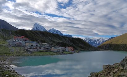
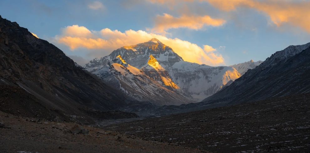
No need for too early a breakfast today, as it's just a short morning's walk up to Panch Pokhari. Heading steeply away from Nosyampati, on sections of carefully constructed stone steps, we are soon above the trees and there are views northwards to the snow-peaks of the Jugal Himal. We pass a narrow, rocky cleft at Chhata Ghabha and beyond a high point at the Laurebina La (4074m) continue to the five lakes at Panch Pokhari. We will set up camp, have lunch and then hike up (30 minutes) to the viewpoint above the lakes. Festooned with prayer flags this is one of the best places from which to view the principal Jugal Himal peaks of Dorje Lakpa (6966m), Madiya (6257m) and Phurbi Chhyachu (6637m).
We have a leisurely start to the day, time for more exploration, before setting off on an exciting, and recently established trail that will (tomorrow) take us down to Chhendang at the junction of the Balephi Khola and Ne-Pemachhal streams. We start out by ascending to the 'ridge top' viewpoint at 4229 metres and from here descend in a north-easterly direction, following a basic shepherds' track. The trail descends along a forested ridge to our camping place at the largest of several clearings, Nema-Gchukpa Kharka (3580m).
After breakfast at camp, we continue to descend on the shepherds' trail through a forest of fir trees and rhododendron to the Balephi Khola river. We cross the river on a makeshift bridge and hike away from the river to our camping site at Chhendang (2635m). There is an old monastery here which is in a state of disrepair following the 2015 earthquake.
Steep-sided and well wooded, the beautiful valley of Ne-Pemachhal is the location of a pilgrimage and meditation site which celebrates the belief that the Guru Rinpoche (Padmasambhava) visited the valley in the 8th century. Heading up into the valley, with some sections of narrow and exposed trail, we reach the rock overhang at Tongsyup Gufa, historically a place of meditation for Buddhist monks. Then, crossing a tributary stream, we complete a more level final kilometer of trekking to our camping place at Ne-Pemachhal (3500m).
Before continuing our approach to Jugal Himal Base Camp, we take the opportunity to visit a great viewpoint at the place known as Gyap Kharka (4400m) on the north side of the Ne-Pemachhal Valley. We hike up directly and steeply, in part on a new stepped trail, to the single shelter at Bumpasherpu (4200m) and then traverse the valley slopes to Gyap Kharka (4400m) where the trail ends. From here we can look across to the location of base camp and the ring of peaks that encircle the Jugal Glacier. Phurbi Chhyachu (6637m) is the dominating mountain to the east. We return to spend a second night at Ne-Pemachhal.
This morning we cross the Ne-Pemachhal River and trek easily through forest on the south side of the river. We can see the peaks of the Jugal Himal ahead, including Phurbi Chhyachu, as well as the steepening of the valley through which we must pass tomorrow. We set up our camp in a side-valley at Palmothang, have lunch and spend the afternoon at leisure.
Today's short and at times steep and complicated stage takes us beneath the precipitous lower slopes of Phurbi Chhyachu before making its way up on a poor trail that involves some easy scrambling, protected in places by short sections of fixed rope and cable. We pass a small glacial lake below Phurbi Chhyachu and continue, traversing around, to Yang Kharka (4700m), the spectacular basecamp area for the Jugal peaks.
We have some time in the morning to enjoy the experience of being in the special place, very much a 'mountain sanctuary' and a place that few have visited. The views of the encircling peaks are sensational. Mid-morning we will begin our walk-out, making a slow and careful descent of the steep riverside trail and then continuing more easily via Palmothang and through the atmospheric forest to Ne-Pemachhal (3500m) where we camp.
This long final trekking stage takes back to the Balephi Khola and then southwards on a reasonable trail, through a number of small settlements, including Dippu, the highest permanent settlement in the valley. The trail climbs and descends beyond Dippu through forest and terraced fields and there are a couple of river crossings en route to our final camping place of the trip at Tembathang (2200m). This is a Sherpa Village with about 150 homes, as well as the usual stupas and mani walls. The inhabitants are keen to show off their Sherpa culture. The raising of livestock, including yaks, is the main occupation.
We have a short walk to the roadhead at Nesam Khola, where we meet our transport for the 6 to 7 hour drive back to Kathmandu. We will stop off for lunch at a roadside restaurant and reach the city in the late afternoon. After checking in at the group hotel, we have some to relax and freshen-up before heading out to one of the Thamel restaurants for a celebratory dinner.
Your holiday ends after breakfast. Transfers to Kathmandu Airport are provided. To extend your holiday in Nepal, why not pre-book a day's sightseeing tour in the Kathmandu Valley, or a multi-day excursion to the wildlife reserve at Chitwan. Contact our office for details.
Cost Includes
- 2 nights Kathmandu on Bed & Breakfast.
- 13 nights Tented Camp on Full Board.
- Langtang National Park Fees & TIMS Permit Fee.
- 1 English speaking trekking guide.
- All Camping staff.
- Trek Staffs insurance, food, accommodation & daily wages.
- All transfers in private vehicle.
- First aid kit.
Cost Excludes
- International flight.
- Lunch and Dinner in Kathmandu.
- Personal Equipment & Insurance.
- Personal Expenses (Battery recharge on local lodge, laundry, telephone, etc).
- Nepal Visa Fee.
- Emergency Evacuation if required.
- Other personal Expenses.
- Tips for Staffs.
FAQS
Located in Sindhupalchok district at an elevation of 3,800 meters, Jugal Himal rises to 6,095 meters, forming a natural border between Nepal and Tibet.
Altitude is by far the most challenging aspect of the trek and is what makes it more difficult than your average trek of the same length. Acute Mountain Sickness and other altitude related illnesses are a serious risk at the sort of altitudes encountered on the trek.
140 kilometers.
Map